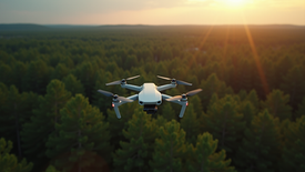
Skyview Drones Services
Owatonna - Professional Aerial Solutions
Offering Aerial Photography, Thermal Imaging, LiDAR Mapping, and More.
Custom Drone Services for Every Industry in Minnesota
Skyview Drones Services in Owatonna specializes in professional drone services designed to meet diverse needs. From thermal imaging and LiDAR mapping to aerial photography and pet recovery, our expert team ensures high-quality results for every project. Based at 105 Southview Street, Owatonna, MN, we provide reliable and advanced drone solutions tailored to your industry, ensuring precise and efficient outcomes.

Find Your Lost Pet Fast
Thermal Drone Rescue Across Southern Minnesota.
If your pet is missing, time is critical. At SkyView Drone Services, we offer fast, effective thermal drone search and rescue for lost pets across southern Minnesota. Our FLIR-equipped drones can detect heat signatures in fields, woods, neighborhoods—even in total darkness.
Why Choose SkyView for Lost Pet Search?
-
FLIR thermal imaging for day/night searches
-
Trusted by families, shelters, and rescue teams
-
Immediate dispatch within a 200-mile radius of Owatonna, MN
-
No payment required until we meet and begin your search
-
Real results — fast reunions, happy families
Be cautious—many fake "drone pet recovery" services ask for money up front. We never will.
24/7 Pet Recovery with FLIR Thermal Imaging

Thermal Imaging & LiDAR Mapping
Fast, Accurate Aerial Data
SkyView Drone Services delivers high-resolution thermal imaging and LiDAR drone mapping across Minnesota. Whether it’s infrastructure inspections, emergency response, or topographic surveys, our aerial data helps you act fast with precision.
Why Leading Industries Trust SkyView’s Aerial Data Services
-
LiDAR scanning for topographic mapping and 3D modeling in construction, agriculture, and land development
-
Thermal drone imaging for infrastructure inspections, energy audits, and emergency search & rescue operations
-
Fast, affordable 3D data capture with centimeter-level accuracy
-
Expert drone pilots using advanced thermal and LiDAR sensors for maximum data reliability

Drone Solutions for Every Industry in Minnesota and Beyond
SkyView Drone Services delivers precision aerial data solutions using cutting-edge drone technology. Whether you operate in agriculture, construction, energy, or public safety, our services help you reduce costs, improve efficiency, and make data-driven decisions—faster.
Industries We Serve with Aerial Drone Technology


GET INSIGHTS FROM THE SKYVIEW EXPERTS
Explore the latest drone industry news, technology insights, and SkyView updates.

OUR PARTNERS
We work with businesses and brands across a variety of industries.


.png)
.png)
.png)
.png)
.png)
.png)
.png)
.png)
.png)


